
The two essential ingredients in every hurricane are warm water and moist warm air. That’s why hurricanes begin in the tropics. Hurricane season in the Atlantic begins June 1st and ends November 30th. The Eastern Pacific hurricane season begins May 15th and also ends November 30th. Most Atlantic hurricanes start to take shape when thunderstorms along the west coast of Africa drift out over warm ocean waters that are at least 80 degrees Fahrenheit (27 degrees Celsius), where they encounter converging winds from around the equator.
 Hurricanes start when warm, moist air from the ocean surface begins to rise rapidly, where it encounters cooler air that causes the warm water vapor to condense and to form storm clouds and drops of rain. The condensation also releases latent heat, which warms the cool air above, causing it to rise and make way for more warm humid air from the ocean below.
As this cycle continues, more warm moist air is drawn into the developing storm and more heat is transferred from the surface of the ocean to the atmosphere.
Hurricanes start when warm, moist air from the ocean surface begins to rise rapidly, where it encounters cooler air that causes the warm water vapor to condense and to form storm clouds and drops of rain. The condensation also releases latent heat, which warms the cool air above, causing it to rise and make way for more warm humid air from the ocean below.
As this cycle continues, more warm moist air is drawn into the developing storm and more heat is transferred from the surface of the ocean to the atmosphere.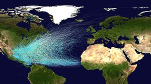 This continuing heat exchange creates a wind pattern that spirals around a relatively calm center, or eye, like water swirling down a drain. Converging winds near the surface of the water collide, pushing more water vapor upward, increasing the circulation of warm air, and accelerating the speed of the wind. At the same time, strong winds blowing steadily at higher altitudes pull the rising warm air away from the storm’s center and send it swirling into the hurricane’s classic cyclone pattern.
High-pressure air at high altitudes, usually above 30,000 feet (9,000 meters), also pull heat away from the storm’s center and cool the rising air. As high-pressure air is drawn into the low-pressure center of the storm, the speed of the wind continues to increase.
As the storm builds from thunderstorm to hurricane, it passes through three distinct stages based on wind speed:
This continuing heat exchange creates a wind pattern that spirals around a relatively calm center, or eye, like water swirling down a drain. Converging winds near the surface of the water collide, pushing more water vapor upward, increasing the circulation of warm air, and accelerating the speed of the wind. At the same time, strong winds blowing steadily at higher altitudes pull the rising warm air away from the storm’s center and send it swirling into the hurricane’s classic cyclone pattern.
High-pressure air at high altitudes, usually above 30,000 feet (9,000 meters), also pull heat away from the storm’s center and cool the rising air. As high-pressure air is drawn into the low-pressure center of the storm, the speed of the wind continues to increase.
As the storm builds from thunderstorm to hurricane, it passes through three distinct stages based on wind speed:- Tropical depression—wind speeds of less than 38 miles per hour (61.15 kilometers per hour)
- Tropical storm—wind speeds of 39 mph to 73 mph (62.76 kph to 117.48 kph)
- Hurricane—wind speeds greater than 74 mph (119.09 kph)

There was a strong indication that El Niño would form in time to suppress the peak of the hurricane season and El Niño just hasn't formed yet. The main reason for the recent abundance of cyclones is that since 1995, the Atlantic Ocean basin has been in the warm phase of a cyclical climate pattern called the Atlantic Multidecadal Oscillation, with hotter-than-average surface temperatures throughout the tropics and subtropics.
This pattern lasts for about 25-40 years, and comes with more hurricanes than its "cool" phase.
Warm water helps hurricanes form and fuels their strength.
In addition, in the past few years there has also been a strong West African monsoon, which creates disturbances in the eastern Atlantic that can turn into cyclones (the generic name for hurricanes and tropical storms).
 There's also been relatively weak wind shear in the tropical Atlantic where cyclones form. Wind shear is a difference in wind speed or direction between the low and high atmosphere, which tears apart developing storms. Wind shear is the main way El Niño hampers cyclone formation. One thing that likely isn't to blame for the increase in hurricanes in recent years is global warming. Many climate models suggest that increased temperatures could actually lead to fewer, but stronger, hurricanes worldwide.
An average hurricane season has six hurricanes, but also about 25 hurricane days. The cyclones this year haven't been as strong as usual, with only one major hurricane, defined as Category 3 or stronger on the Saffir-Simpson scale.
Better technology also allows us to detect more hurricanes than in the past. In recent decades satellites have significantly increased the detection of tropical storms that last less than 36 hours. This year there have been three tropical storms that lasted less than 1.5 days: tropical storms Helene, Joyce and Patty. These storms might have been missed in the pre-satellite era, and indeed, some storms actually could have been, meaning more seasons may have been as busy as this one has been. But regardless of what the hurricane season forecast is, people who live near the Atlantic or the Gulf of Mexico need to be prepared for storms.
While the scientific community debates the root cause of the temperature changes that are contributing to the current increase in destructive hurricanes, three things are apparent:
- Air and water temperatures are rising worldwide.
- Human activities such as deforestation and greenhouse gas emissions from a wide range of industrial and agricultural processes are contributing to those temperature changes at a greater rate today than in the past.
- Failure to take action now to lower atmospheric levels of greenhouse gases is likely to lead to more frequent and severe hurricanes in the future.
 Back in the 1960's Project Stormfury was an attempt to weaken tropical cyclones by flying aircraft into storms and seeding the eyewall with silver iodide. The project was run by the United States Government from 1962 to 1983. A similar project using soot was run in 1958, with inconclusive results.
The last experimental flight was flown in 1971, due to a lack of candidate storms and a changeover in NOAA's fleet. More than a decade after the last modification experiment, Project Stormfury was officially canceled. Although a failure in its goal of reducing the destructiveness of hurricanes, Project Stormfury was not without merit. The observational data and storm lifecycle research generated by Stormfury helped improve meteorologists' ability to forecast the movement and intensity of future hurricanes. Perhaps in recent years the increasing severity of hurricanes would require a man-made solution for weather modification. Considering the cost of prevention would prove to be less costly. The future suggests an increase in hurricanes with no end in sight of any other changes. The logical thing would be to open up old files of project storm-fury and look into ways of weather modification and prevention. By then we might have a chance of stopping a drought or reduce the destructive forces of a hurricane...
No comments:
Post a Comment